Research Resources
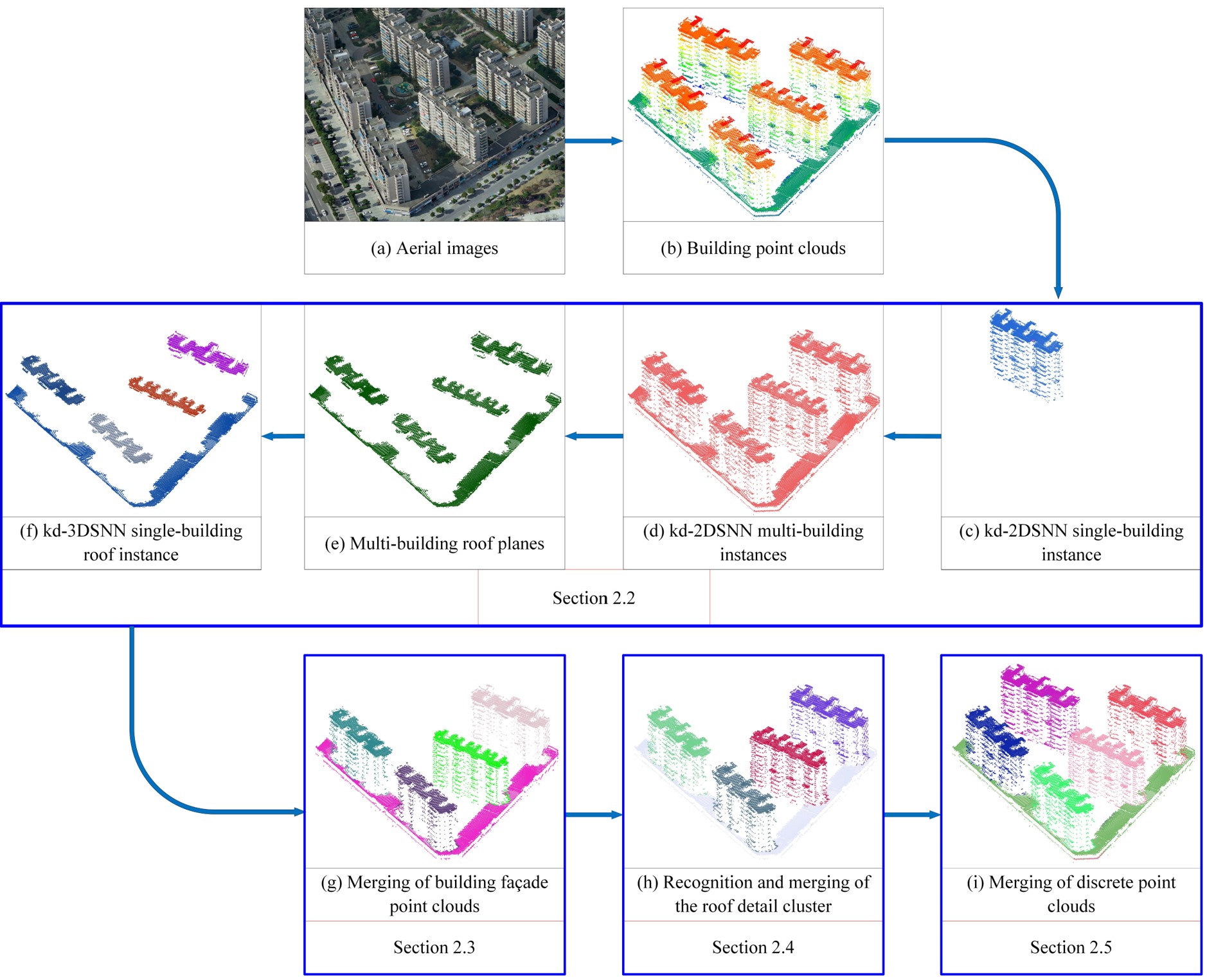
Unsupervised Building Instance Segmentation of Airborne LiDAR Point Clouds for Parallel Reconstruction Analysis
Remote Sensing, 2021
Yongjun Zhang*, Wangshan Yang, Xinyi Liu*, Yi Wan, Xianzhang Zhu, Yuhui Tan
Efficient building instance segmentation is necessary for many applications such as parallel reconstruction, management and analysis. However, most of the existing instance segmentation methods still suffer from the low-completeness, low-correctness and low-quality for building instance segmentation, which are especially obvious for complex building scenes. This paper proposes a novel unsupervised building instance segmentation (UBIS) method of airborne LiDAR point clouds for parallel reconstruction analysis, which combines clustering algorithm and a novel model consistency evaluation method...
[Dataset] | [Demo] | [related publications]
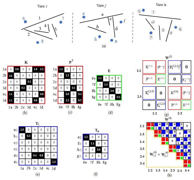
Robust line segment matching across views via ranking the line-point graph
ISPRS Journal of Photogrammetry and Remote Sensing, Volume 171, January 2021
Dong Wei, Yongjun Zhang, Xinyi Liu, Chang Li, Zhuofan Li
Line segment matching in two or multiple views is helpful to 3D reconstruction and pattern recognition. To fully utilize the geometry constraint of different features for line segment matching, a novel graph-based algorithm denoted as GLSM (Graph-based Line Segment Matching) is proposed in this paper, which includes: (1) the employment of three geometry types, i.e., homography, epipolar, and trifocal tensor, to constrain line and point candidates across views; (2) the method of unifying different geometry constraints into a line-point association graph for two or multiple views; and (3) a set of procedures for ranking, assigning, and clustering with the line-point association graph...
[Dataset] | [Demo] | [code] | [related publications]
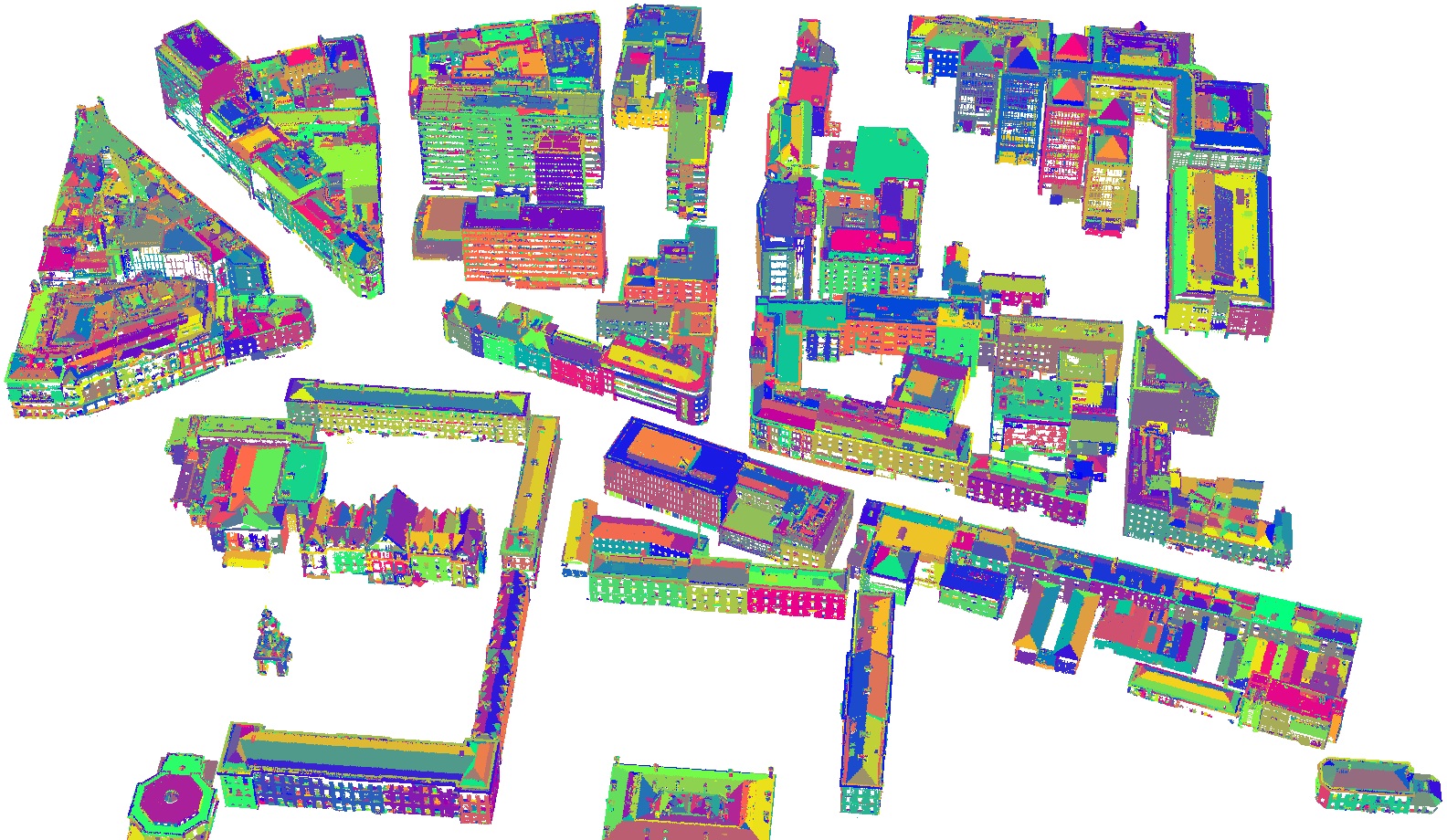
QTPS: Robust 3D plane segmentation from airborne point clouds based on quasi-a-contrario theory
2020
Xianzhang Zhu, Xinyi Liu, Yongjun Zhang, Yi Wan, Yansong Duan
[Dataset] | [Demo] | [code]
CoFSM: Multi-modal Remote Sensing Image Matching Considering Co-occurrence Filter
2020
Yongxiang Yao, Yongjun Zhang, Yi Wan, Xinyi Liu, Xiaohu Yan, Jiayuan Li
[Dataset] | [Demo]
WDCD: Accurate cloud detection in high-resolution remote sensing imagery by weakly supervised deep learning
Remote Sensing of Environment, Volume 250, 1 December 2020
Yansheng Li, Wei Chen, Yongjun Zhang, Chao Tao, Rui Xiao, Yihua Tan
Cloud cover is a common and inevitable phenomenon that often hinders the usability of optical remote sensing (RS) image data and further harms the continuous cartography based on RS image interpretation. To alleviate the labor of annotating the pixel-level labels, this paper proposes a weakly supervised deep learning based cloud detection (WDCD) method using block-level labels indicating only the presence or the absence of cloud in one RS image block. ...
[Dataset] | [related publications]